Engels Meadows Hike
Engels Meadows is a scenic area that can be visited on a full-day hike from the Wakhan Valley. Starting from the Panj River and climbing gradually into the southern Pamirs, the route leads to high mountain pastures below the steep rock walls of Engels Peak. Without technical difficulties but with wide views over the Wakhan Valley and dramatic mountain backdrops, this hike offers a good impression of the landscapes that make the Wakhan Valley such a special place to visit.

Engels Peak
The Wakhan Valley (or Panj Valley) in the southern Pamirs, at the border with Afghanistan, is a highly sought-after destination, yet one of the most remote parts of Tajikistan to reach. The valley is surrounded by high mountains and an endless sequence of stunning landscapes. Traveling through the Wakhan Valley offers breathtaking scenery, and hiking is another great way to experience the area even better. One of the most rewarding routes is the hike to Engels Meadows
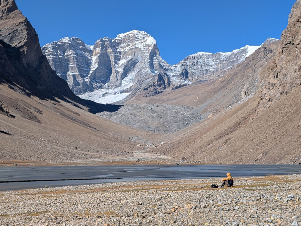
Engels Peak (6.510 m) itself is one of the major mountains in the southern Pamirs. It is part of the Shohdara Range, which separates the Shohdara River from the Panj River. Together with nearby Karl Marx Peak (6.726 m), it forms an important mountain group in this part of the Pamirs. The peak is named after the German philosopher Friedrich Engels and was first climbed in the 1950s. Despite its height, Engels Peak is actually not very well visible from bottom of the Wakhan Valley and only comes into view when hiking higher into the mountains. So seeing it requires some effort!
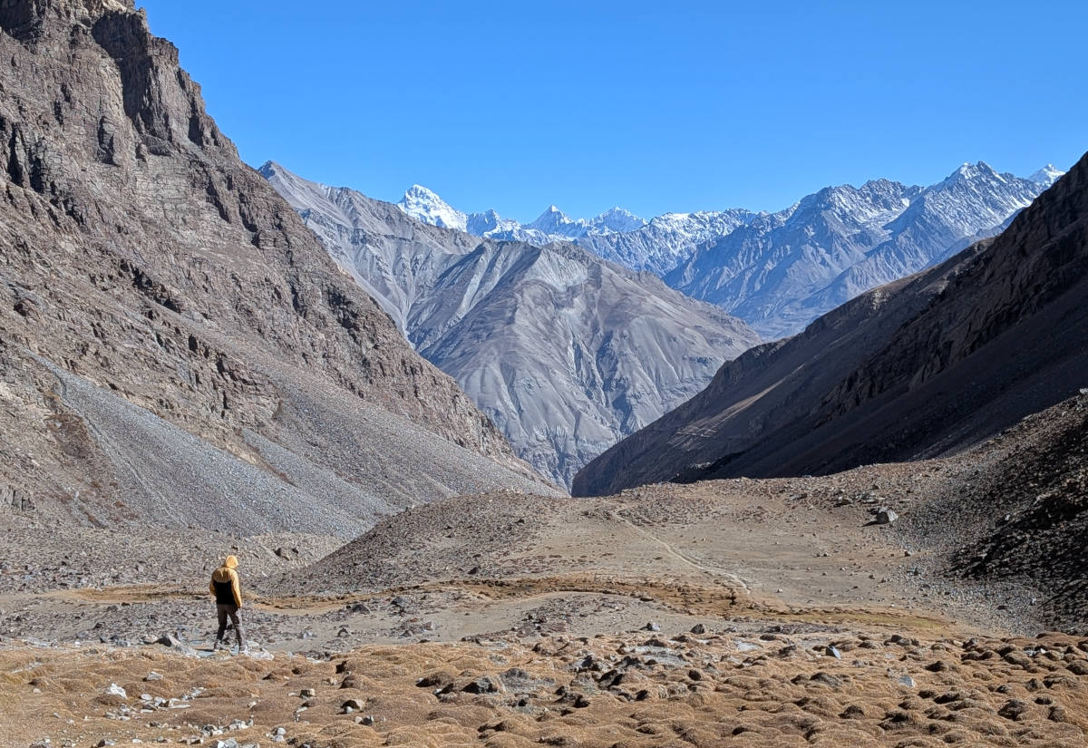
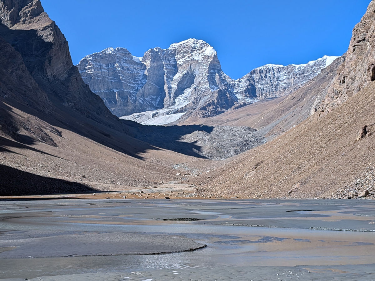
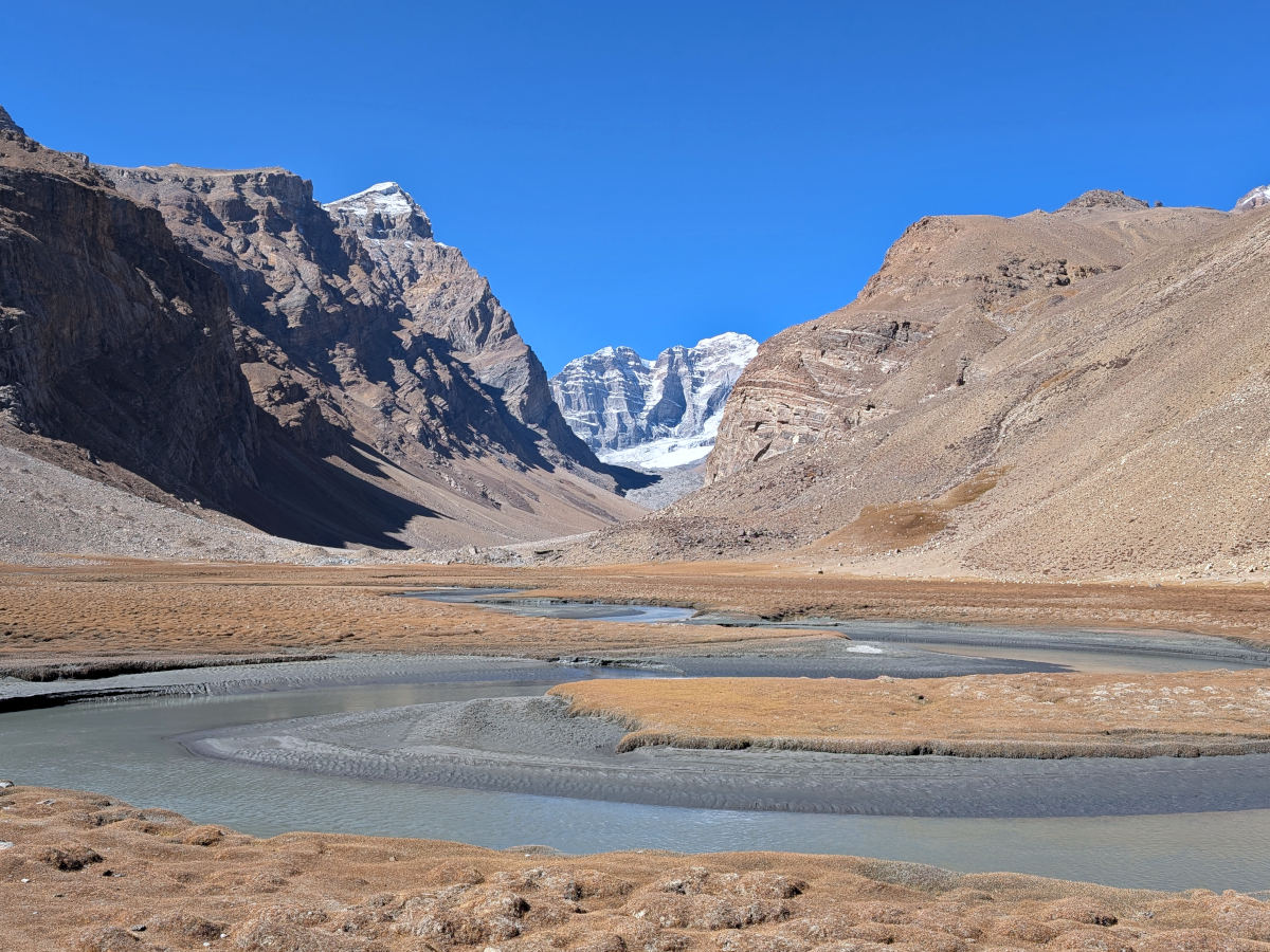
Whereas climbing Engels Peak is a serious mountaineering objective, you can also simply go to the meadows at the southern foot of the mountain without technical difficulties. The Engels Meadows are located right below the steep rock flanks of Engels Peak.
Trail
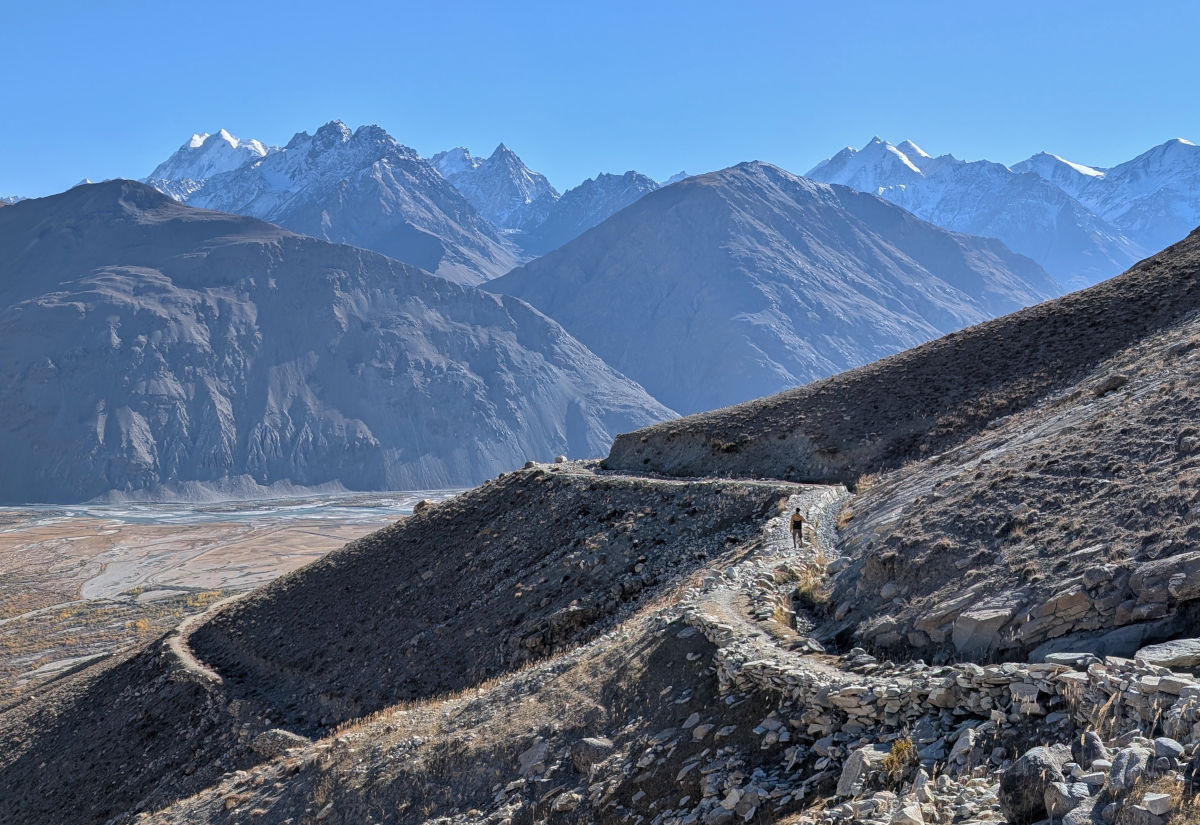
The round-trip hike to Engels Meadows is about 20 km long and usually takes a full day. The trail starts near the village of Dirj. From the main road along the Panj River, it is possible to drive from Zong towards Dirj and continue as far as the road allows to shorten the walking distance.
From Dirj, you hike up for a while, and soon afterwards, the hiking trail starts following an irrigation channel that brings water from the Engels Meadows down to the village. Thanks to this, most of the hike has a very steady and gentle ascent and is never really steep, making for easy and pleasant hiking.
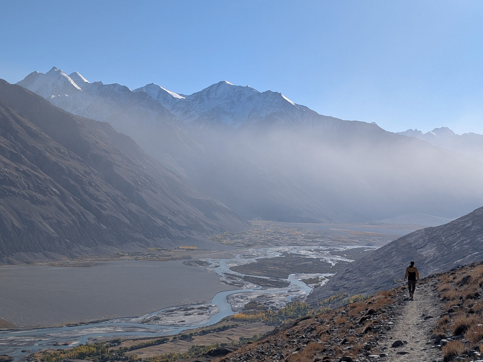
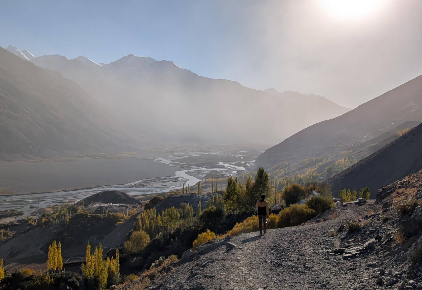
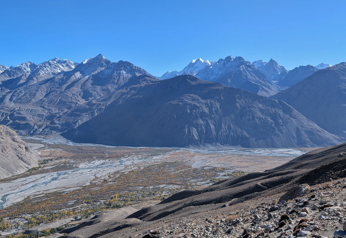
As you gain height, wide views over the Wakhan Valley gradually open up. From the trail, you can see long stretches of the valley and the surrounding mountains. The confluence of the Pamir and Wakhan rivers, which together form the Panj River, is also clearly visible.

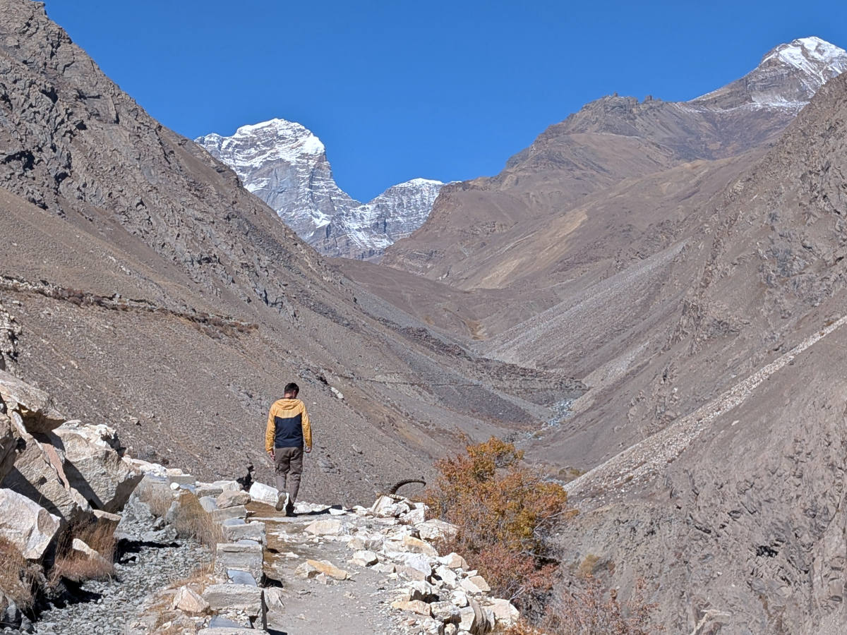
After some time, the trail turns away from the main valley and enters the side valley of the Kishtijarob River, from which the irrigation channel is diverted. Here, the route continues mostly flat for a while, following the water channel deeper into the valley.
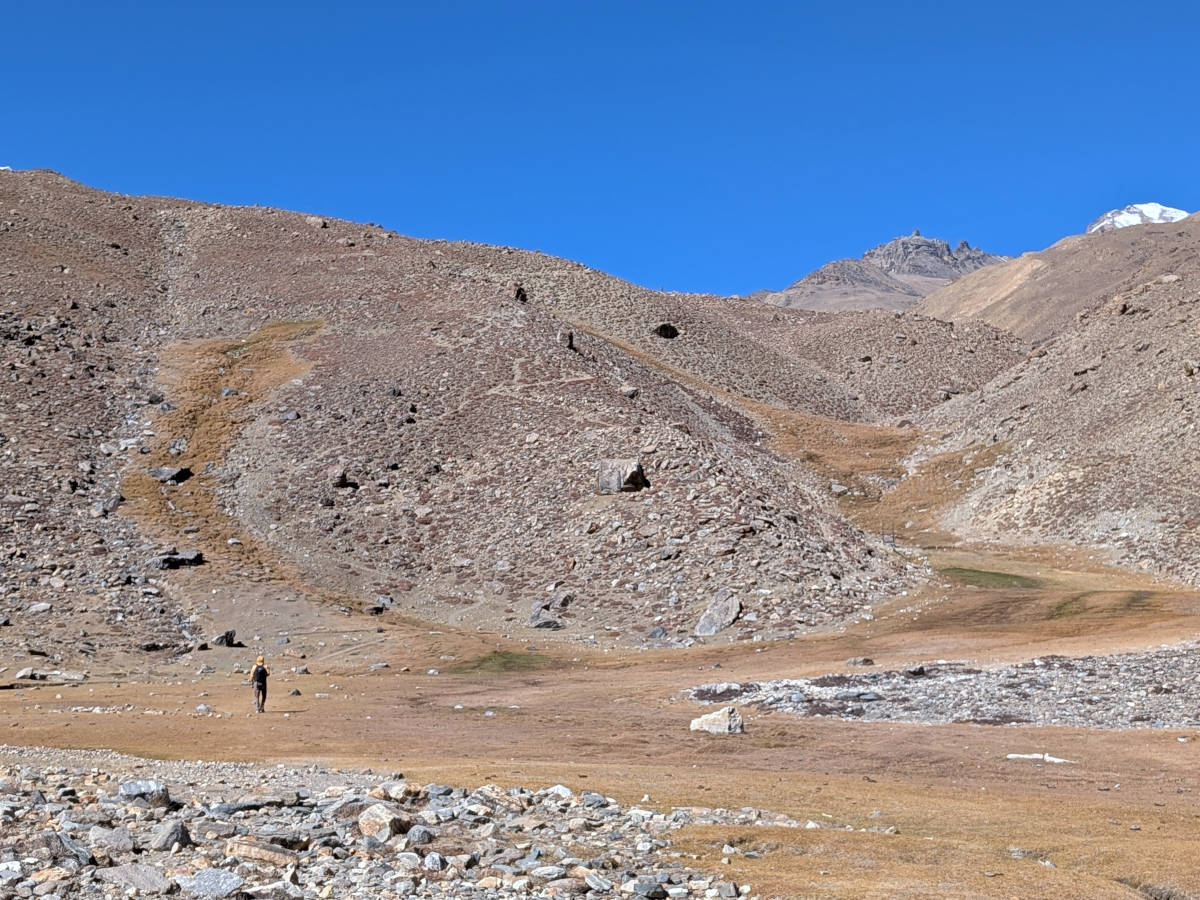
Towards the end of the hike, the trail leaves the irrigation channel and climbs more steeply for a short distance. After these final inclines, the terrain opens up and Engels Meadows come into view, lying directly below the rock walls of Engels Peak. The last few kilometers are flat straight across the meadows.
The descent follows the same route back to Dirj. Depending on the time of day, the changing light often gives the Wakhan Valley a different look on the way down, making the return hike just as enjoyable as the ascent.