Bel Ayrik Hike
The Bel Ayrik hike in the high-altitudes of the eastern Pamir Mountains offers stunning views over the remote landscapes of the Zorkul area. At 4.800 meters, the pass provides a vantage point of Zorkul Lake without requiring a special permit, making it an accessible way to experience this beautiful region. Reaching the trailhead itself is already an adventure, with a long drive through the vast desert plains of the Gurumdy Valley. The hike itself follows a gentle valley ascent, with a steep climb only near the end. For those with extra time, the trip can be combined with a visit to Koluchkul Lake.

Zorkul
Zorkul is one of the most remote lakes in the Pamirs, lying directly on the border between Tajikistan and Afghanistan. Visiting the lake itself requires a special permit, and access is further complicated by its isolation and the extensive marshlands that surround it. For hikers who want to still catch a glimpse of this landscape without entering the restricted zone, the Bel Ayrik Pass hike offers a nice alternative. This 12-kilometer hike climbs to Bel Ayrik Pass (4,800 meters), located exactly on the edge of the Zorkul permit area.
From the Bel Ayrik pass, wide panoramic views open up across the Zorkul basin and the surrounding high Pamir plateau. Zorkul Lake itself sits at an altitude of roughly 4.100 meters and forms part of a high-altitude wetland system. The area is known for its birdlife, including migratory species, and for its role as the source region of the Pamir River.
Trailhead
The trailhead for the Bel Ayrik Pass hike is pretty remote, reached only by long drives across rough tracks in the eastern Pamirs. This isolation also makes this hike extra special and adds to the sense of being deep within one of Central Asia’s most rugged regions.
Access to the hike is gained via the Gurumdy Valley, which branches off the Pamir Highway about 40 kilometers west of Alichur, shortly after passing the distinctive Chatyr Tash rock formation. From the highway, a gravel track leads into the Gurumdy Valley, which crosses vast desert plains with several dry or semi-dry riverbed crossings along the way.
After driving 20 km up the Gurumdy Valley, a right-hand turn leads into the Bel Ayrik Valley, a side valley that must be followed for approximately another 15 kilometers. Near the entrance of the Bel Ayrik Valley lies the Keng Shiber outpost, where even some basic accommodation is available. The track continues upstream until it eventually fades out, marking the start of the hike. From here, around 6 kilometers remain on foot to reach Bel Ayrik Pass.
A high-clearance vehicle is strongly recommended to reach the trailhead. While most riverbeds are usually dry and passable, conditions can change, and the rough terrain makes the approach challenging.


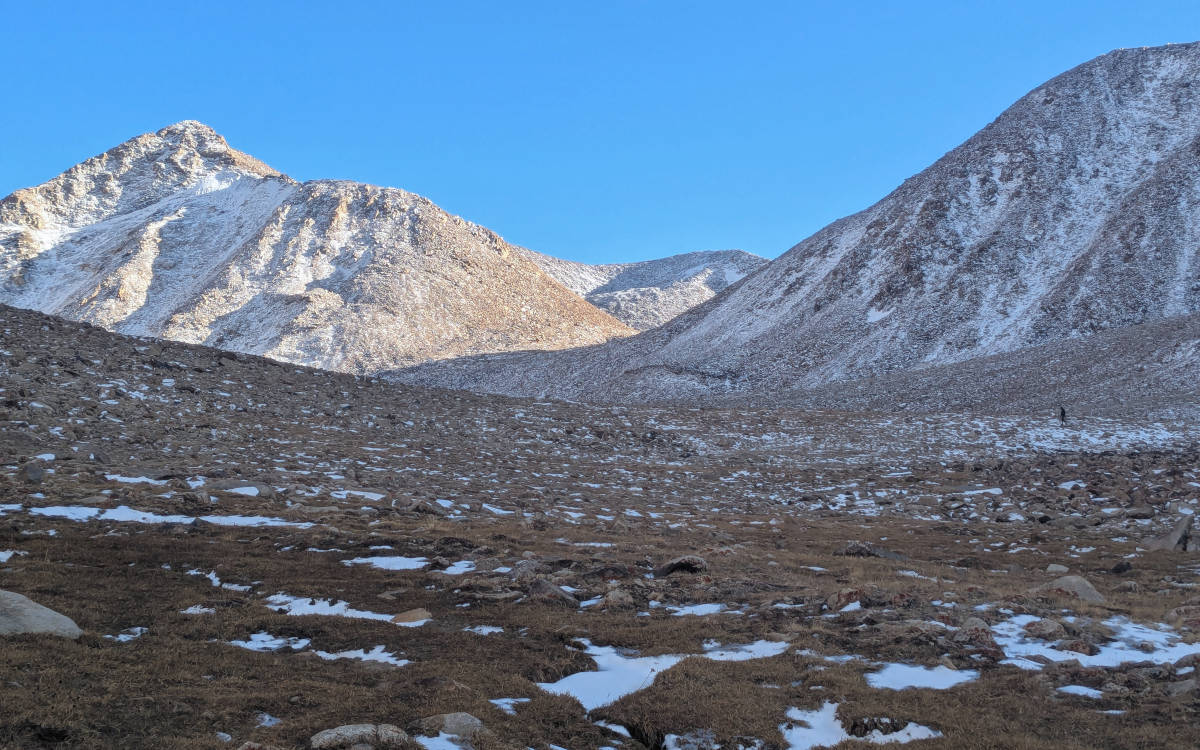
Trail
The hike to Bel Ayrik Pass follows a straightforward route. From the trailhead, the path leads steadily up the Bel Ayrik Valley, with a mostly gentle and gradual ascent. For much of the hike, navigation is intuitive, as the valley naturally guides the route upward.
Near the head of the valley, the terrain changes and the final approach to the pass becomes significantly steeper. This last section consists of loose rock and scree and often holds snow, as the slope faces north and receives little direct sunlight.
At the Bel Ayrik Pass (4.800 meters), wide views open up toward the Zorkul basin and the surrounding high Pamir plateau. If you still have energy after the climb, it is possible to climb one of the nearby side peaks for an even broader panorama.
The descent follows the same route back down the valley.


Koluchkul
The hike to Bel Ayrik Pass can also be combined with a visit to Koluchkul, a quiet lake located in another side valley of the Gurumdy Valley. The drive from the main valley to Koluchkul is about 15 kilometers, and the road becomes very rocky close to the lake (so only go here with a good car!). Koluchkul Lake makes it a nice additional stop for those exploring the area.


