Kangurt-Nurek Hike
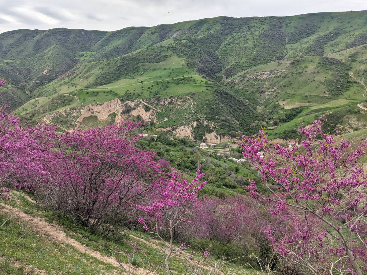
The Nurek Reservoir, located on the Vakhsh River east of Dushanbe, is one of the largest reservoirs in Tajikistan. The immense lake is a striking landmark surrounded by rugged hills and mountain valleys. This article describes a hike to a crest on the south shore of the reservoir, with panoramic views over the lake, the Dashtimaidonsky Nature Refuge and the landscapes further south. Spring is a good time for this hike in particular, as the valley is dotted with bright purple Afghan redbud blossoms, adding vibrant color to the landscapes.
Nurek Reservoir
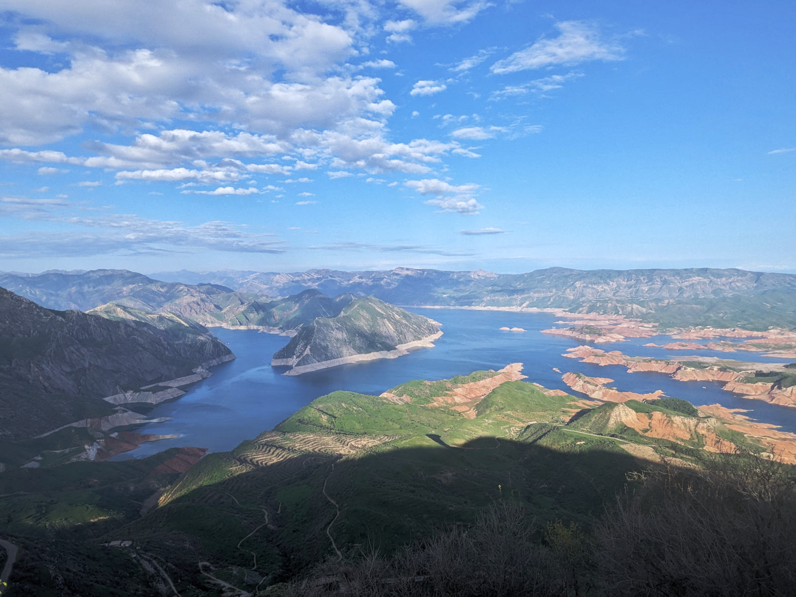
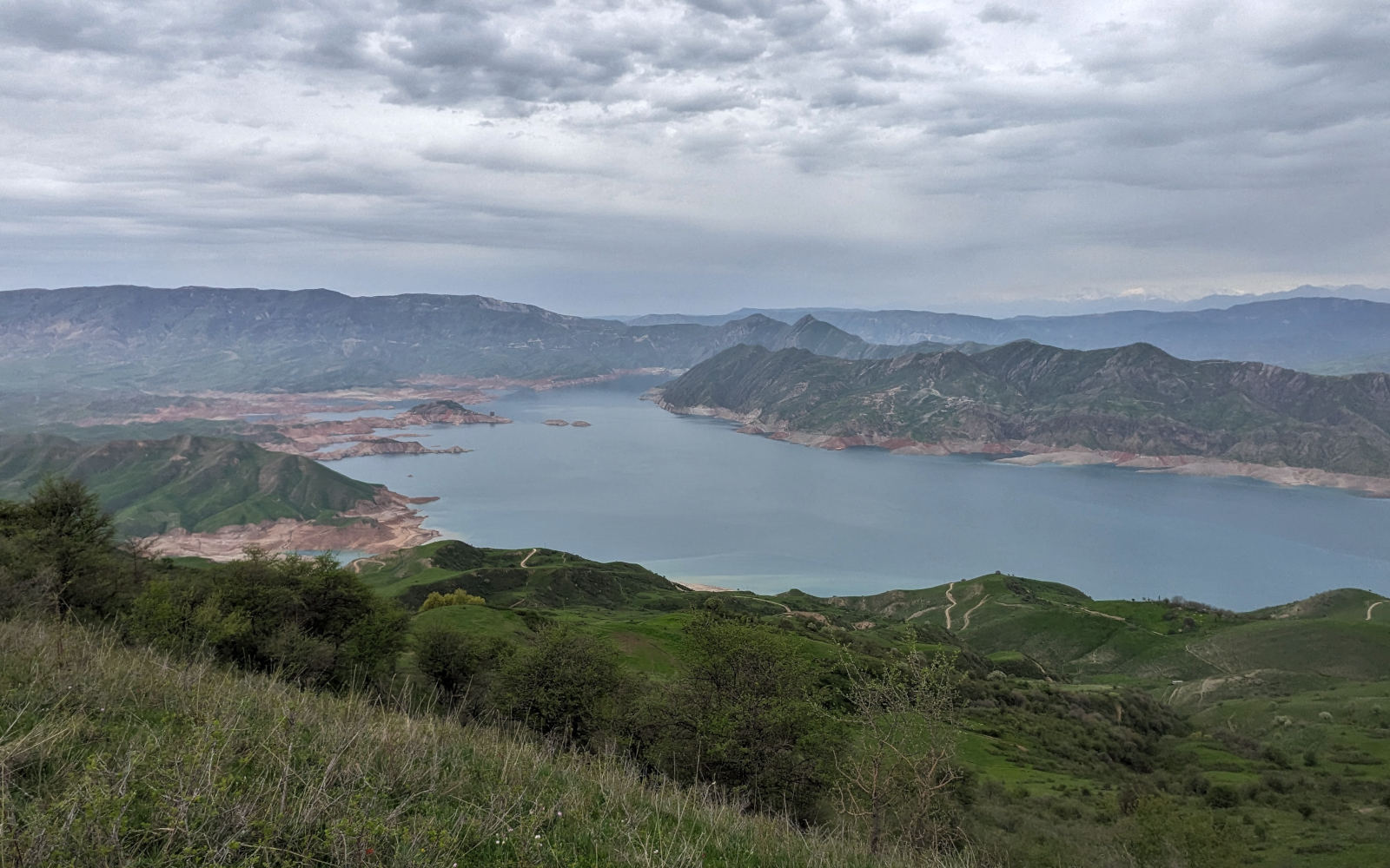
Th Nurek Reservoir is vast artificial lake formed by the Nurek Dam on the Vakhsh River. The lake is a major landmark stretching over 70 km in length with a surface area of nearly 98 km² and holding more than 10.5 billion cubic meters of water, making it one of the largest reservoirs in Tajikistan
The Nurek Dam was completed between 1961 and 1980 during the Soviet era. Rising 300 m above the river valley, it was the tallest dam in the world at the time of its completion and still remains second tallest of the world today. Its primary purpose is hydroelectric power generation. The associated power station supplies around 70% of the country’s electricity, underscoring its central role in Tajikistan’s energy system.
In addition to producing electricity, the reservoir plays a vital role in regional water regulation and irrigation, with water conveyed through long tunnels to irrigate agricultural land far downstream. The lake also helps regulate the seasonal flow of the Vakhsh River.
Nurek and its dam are located about 70–75 km east of Dushanbe. The reservoir is a dominant feature in the area and can be seen from many surrounding hills and roads. This article describes a hike to a viewpoint on the south shore of the reservoir. From the crest, there are clear views of the Nurek Reservoir, the Dashtimaidonsky Nature Refuge and the landscapes further south. The hike is suitable as a short trip from Dushanbe or as a stop when traveling through southern Tajikistan or towards teh Pamirs.
Trail
The hike starts near the villages of Kangurt and Shuluptu. From Kangurt, continue by road to Shuluptu and then follow a dirt road heading west into the valley. This first section can be done by car, depending on road conditions.
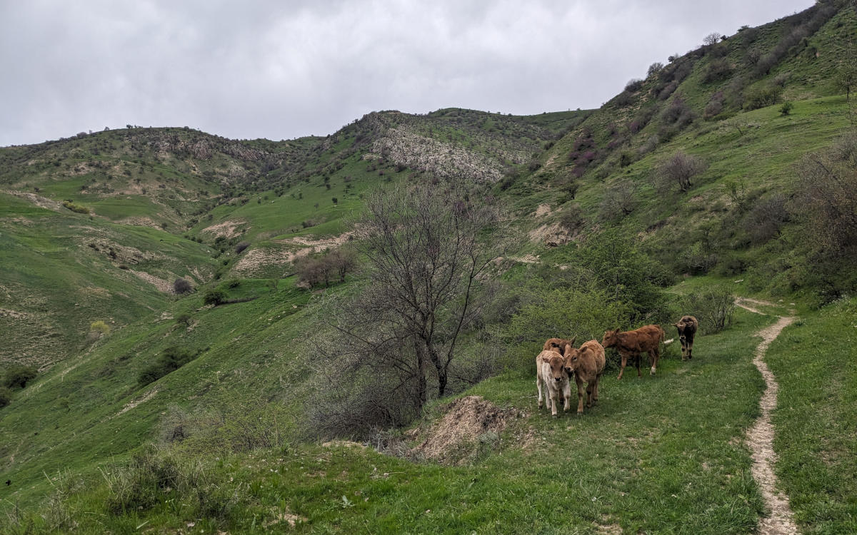
After some distance, the road becomes too rough for vehicles and continues as a hiking trail. From here, the route climbs steadily uphill. The initial ascent is quite steep, but after the first section the slope becomes more gradual and easier to follow.
The trail passes through several small hamlets, consisting of a few houses and farm buildings. These settlements are scattered along the valley and give a glimpse of local rural life.


Eventually, the trail reaches a crest, where the terrain becomes flatter. From this point, continue straight north for a short distance to reach the best viewpoints. Here, the views open up over the Nurek Reservoir, with the Hisar Range visible far in the background on clear days.


If time and energy allow, you can continue walking along the crest. This section offers additional viewpoints, including views toward the Dashtimaidonsky Nature Refuge to the north, recognizable by its rugged, bowl-shaped catchment basin.

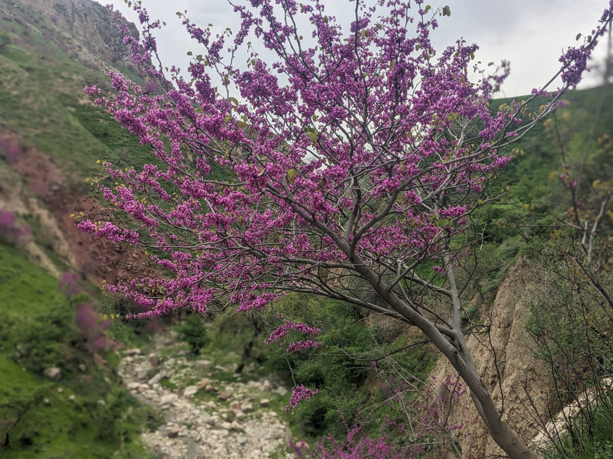
Spring blossoms
Spring is the best time to do this hike. During this season, the valley is green and filled with bright purple Afghan redbud blossoms, which results in an amazing color palette.
Another advantage of spring is the pleasant temperature. Because the hike stays below 2.000 meters, summer temperatures are very hot in this area. In spring, conditions are generally more comfortable for hiking.

Alternative viewpoint
If you do not have the time or energy for a hike, there is also a scenic viewpoint on the west shore of the Nurek Reservoir that can be reached entirely by car. The viewpoint is located along the road and offers wide views over the reservoir and the surrounding mountains. Without any hiking needed, this stop is an easy way to enjoy impressive views of the reservoir from a different angle.